Global Heritage Press
MAPS - Old County Maps of England 1836
MAPS - Old County Maps of England 1836
Couldn't load pickup availability
By Thomas Moule
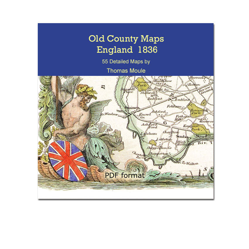
This digital edition of Thomas Moule's Old County Maps of England 1836 faithfully reproduces the original detail and artistry of this fine cartographer. The maps are reproduced in high resolution suitable for detailed viewing of printing (pdf format).
The county maps are very detailed including outlines of the Hundreds, and in some cases the Wapentakes and Liberties. Moule's maps are beautifully embellished with inset views of special features of each county and ornate decoration.
All 55 maps are high resolution so you can enlarge the maps on your computer screen for detailed viewing, or print them to paper. Maps remain very clear on-screen to an enlargement of 300-400%, yet print excellent copies at letter, legal or tabloid size (print quality will vary by printer and paper quality).
Map List:
- England and Wales (with historical counties outlined)
- Bedfordshire
- Berkshire
- Buckinghamshire
- Cambridgeshire
- Cambridge (city and environs)
- Cheshire
- Cornwall
- Cumberland
- Derbyshire
- Devonshire
- Environs of Devonport and Plymouth
- Dorsetshire
- Durham
- Essex
- Gloucestershire
- Hampshire
- Portsmouth
- Herefordshire
- Hertfordshire
- Huntingdonshire
- Kent
- Lancashire
- Leicestershire
- Lincolnshire
- Boston
- Isle of Man
- Middlesex
- London (city)
- Environs of London
- Monmouthshire
- Norfolk
- Northamptonshire
- Northumberland
- Nottinghamshire
- Oxfordshire
- City and University of Oxford
- Rutlandshire
- Shropshire
- Somersetshire
- The City of Bath
- Environs of Bath and Bristol
- Staffordshire
- Suffolk
- Surrey
- Sussex
- Isle of Thanet
- Warwickshire
- Westmoreland
- Isle of Wight
- Wiltshire
- Worcestershire
- Yorkshire North
- Yorkshire West
- Yorkshire East
Share